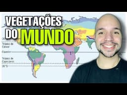
World Vegetation Types Explained: Forests, Savannas, Deserts, Tundra and Mediterranean Scrub
AI summary of “World Vegetation Types Explained: Forests, Savannas, Deserts, Tundra and Mediterranean Scrub” by Professor Ricardo Marcílio, generated by Sumvid.
Title
World Vegetation Types Explained: Forests, Savannas, Deserts, Tundra and Mediterranean Scrub
One-Sentence Summary
A Brazilian geography lesson explains how climate shapes the world's major vegetation types, from equatorial forests and savannas to deserts, tundra, and Mediterranean scrub, and how latitude and altitude change them.
Worth Watching If
You are preparing for a school or university entrance exam (such as Brazil's vestibular) or want a quick, structured overview of the world's main vegetation formations and their climates. It is a straightforward lecture rather than an in-depth analysis, and it includes some tangents and imprecise statements.
Chapters
- [0:00] Introduction: vegetation is treated as a response to climate, which is why geographers have used plants to infer climate
- [1:04] Three vegetation structures (trees, shrubs, herbs) and equatorial and tropical forests such as the Amazon, Mata Atlântica, and the Congo
- [3:10] Broadleaf vegetation, nutrient-poor soils rich in organic litter, high biodiversity, and deforestation hotspots such as the Mata Atlântica and Indonesian forests
- [6:14] Temperate forests, their seasonal leaf loss (deciduous species), and their heavy historical deforestation
- [8:20] Savannas, including Africa's savannas and Brazil's Cerrado, plus seasonal adaptations and uses of cork and charcoal
- [10:29] Deserts, their link to high-pressure zones near the tropics, xerophytic plants, and the explanation of mirages and oases
- [13:04] Steppes and prairies, grassland climates, and their use for livestock grazing
- [15:07] Coniferous forests (taiga), needle-like leaves adapted to snow, and their economic value for timber and paper
- [17:40] Tundra in polar and subpolar climates, its short summer growing season, and limited economic use
- [18:40] Altitudinal and latitudinal zonation, showing how similar vegetation changes appear up mountains and toward the poles
- [19:42] Mediterranean vegetation (maquis and garrigue), its association with grapes and olives, and its vulnerability to natural fires
- [22:50] Closing remarks
Key Takeaways
- [1:04] Vegetation is treated as a response to climate, and early scholars inferred climate by observing plant cover because they lacked direct measurements.
- [1:04] Vegetation is classified into three structural types: arboreal (large trees), shrubby (small, twisted trunks), and herbaceous (grasses).
- [3:10] Equatorial forests are broadleaf, and their rapid organic decomposition creates a litter layer (serrapilheira), while the underlying soils are mineral-poor.
- [4:12] High temperature and rainfall in equatorial climates favor very high biodiversity, which makes these forests vulnerable to deforestation and designated hotspots.
- [4:43] The speaker states that the Amazon still has about 78% of its original vegetation preserved.
- [6:14] Temperate forests have four distinct seasons and deciduous species, and the speaker describes them as having the world's worst deforestation rates.
- [10:29] Deserts are typically located near 30° north and south, where high pressure suppresses rainfall, and their plants are xerophytes such as cacti and bromeliads.
- [15:07] Coniferous forests have needle-like leaves that shed snow, and Russia and Canada have major timber and pulp and paper industries based on them.
- [17:40] Tundra exists beyond about 66° latitude, with a short summer when mosses and lichens grow, and it supports limited activities such as reindeer or moose grazing.
- [19:42] Mediterranean-climate regions (hot, dry summers and mild, wet winters) host garrigue and maquis vegetation, which is highly flammable and prone to natural fires, especially around July in the Northern Hemisphere.
Action Items
- Use the climate-vegetation relationship as a method: when you see a vegetation type on a map or exam, infer its likely temperature and rainfall patterns, then check them against the latitude and altitude.
- Memorize the approximate latitude ranges for each climate zone (for example, tundra beyond about 66°, deserts near 30°), since the lecture stresses these for exam questions.
- Compare related formations side by side, such as the Brazilian Cerrado with African savannas or steppes with temperate forests, to sharpen distinctions.
Caveats
- The transcript is an auto-generated, error-prone lecture transcript, and it contains several garbled terms, so some details may be misheard.
- The speaker says taiga exists only in Russia, then names Argentina, Canada, and others, contradicting himself. Taiga occurs mainly across Russia, Canada, Alaska, and Scandinavia, not Argentina.
- The claim that the Amazon retains about 78% of its original vegetation is presented without a source and should be verified against current data.
- The claim that temperate forests show the world's worst deforestation rates is stated without evidence.
- Some explanations are oversimplified, such as the mirage explanation and the claim that deserts are "without vegetation."
- The lecture is tailored to Brazilian entrance exams, and the speaker treats exam-oriented framing (for example, calling some regions "tropical forests") as a matter of convention, which may confuse learners who need strict scientific terminology.