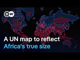
UN Adopts New World Map Resolution to Accurately Represent Continental Sizes
AI summary of “UN Adopts New World Map Resolution to Accurately Represent Continental Sizes” by DW News, generated by Sumvid.
Title
UN Adopts New World Map Resolution to Accurately Represent Continental Sizes
One-Sentence Summary
The United Nations voted to adopt a more accurate map projection to replace the 500-year-old Mercator projection, which significantly distorts the size of continents—particularly Africa—and the resolution aims to reshape global perceptions of the world's geography and geopolitical importance.
Key Takeaways
- [0:00] The UN passed a resolution with 164 member states voting in favor (only the US opposed) to adopt a new map that accurately represents continental sizes, addressing distortions in the centuries-old Mercator projection that makes Africa appear 14 times smaller than it actually is.
- [1:02] The resolution, spearheaded by Togo's African Union, holds symbolic, historical, and cultural significance, as it establishes "a fair world begins with a fair map" and allows Africa to be represented at its true size for the first time on a global stage.
- [2:04] Maps are far more than geographical drawings—they shape mental maps that influence diplomatic negotiations, investment decisions, and global priorities, with distorted maps contributing to continents being sidelined in international affairs.
- [3:06] While the resolution is non-binding, it is historically significant as the first time 164 countries collectively chose accuracy, shifting the burden of proof to those who wish to continue using distorted maps rather than those advocating for accurate ones.
- [4:40] The next steps include implementing accurate maps across UN materials, integrating them into educational curricula and textbooks in African nations, and pressuring tech companies to change default map projections on digital platforms where most people now view the world.
- [6:15] Critics dismissing the importance of map accuracy underestimate the stakes: by 2050, one in four people on Earth will be African, making accurate continental representation crucial for understanding global climate, energy, trade, and security issues.
- [7:18] Accurate maps do not diminish any region but simply show all continents in their true size, correcting a distortion that has affected global understanding of the world's economy and geopolitical landscape for nearly 500 years.